| 地球科学 |
|


|
|
|
| 基于多源遥感数据的大襟岛海域悬浮泥沙观测 |
黄国容1( ),张霄宇1,2,3,*(),韩亚超4,陈嘉星1,张永军4 ),张霄宇1,2,3,*(),韩亚超4,陈嘉星1,张永军4 |
1. 浙江大学 地球科学学院,浙江 杭州 310058
2. 浙江大学 海洋研究院,浙江 舟山 316000
3. 浙江省海洋观测-成像试验区重点实验室,浙江 舟山 316000
4. 中国自然资源航空物探遥感中心,北京 100083 |
|
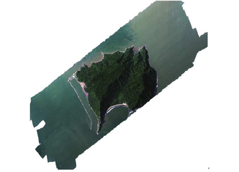
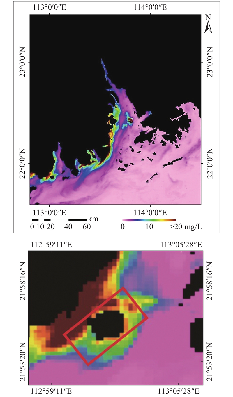
| Observation of suspended sediment in sea area around Dajin Island based on multi-source remote sensing data |
| Guo-rong HUANG1(),Xiao-yu ZHANG1,2,3,*(),Ya-chao HAN4,Jia-xing CHEN1,Yong-jun ZHANG4 |
1. School of Earth Sciences, Zhejiang University, Hangzhou 310058, China
2. Ocean Academy, Zhejiang University, Zhoushan 316000, China
3. Key Laboratory of Zhejiang Ocean Observation-Imaging Testbed of Zhejiang Province, Zhoushan 316000, China
4. China Aero Geophysical Survey and Remote Sensing Center for Natural Resources, Beijing 100083, China |
引用本文:
黄国容,张霄宇,韩亚超,陈嘉星,张永军. 基于多源遥感数据的大襟岛海域悬浮泥沙观测[J]. 浙江大学学报(工学版), 2020, 54(5): 985-995.
Guo-rong HUANG,Xiao-yu ZHANG,Ya-chao HAN,Jia-xing CHEN,Yong-jun ZHANG. Observation of suspended sediment in sea area around Dajin Island based on multi-source remote sensing data. Journal of ZheJiang University (Engineering Science), 2020, 54(5): 985-995.
链接本文:
http://www.zjujournals.com/eng/CN/10.3785/j.issn.1008-973X.2020.05.017
或
http://www.zjujournals.com/eng/CN/Y2020/V54/I5/985
|
| 1 |
疏小舟, 尹球, 匡定波 内陆水体藻类叶绿素浓度与反射光谱特征的关系[J]. 遥感学报, 2000, 4 (1): 41- 45
SHU Xiao-zhou, YIN Qiu, KUANG Ding-bo Relationship between algal chlorophyll concentration and spectral reflectance of inland water[J]. Journal of Remote Sensing, 2000, 4 (1): 41- 45
doi: 10.11834/jrs.20000108
|
| 2 |
张兵, 申茜, 李俊生, 等 太湖水体3种典型水质参数的高光谱遥感反演[J]. 湖泊科学, 2009, 21 (2): 182- 192
ZHANG Bing, SHEN Qian, LI Jun-sheng, et al Retrieval of three kinds of representative water quality parameters of Lake Taihu from hyperspectral remote sensing data[J]. Journal of Lake Science, 2009, 21 (2): 182- 192
doi: 10.3321/j.issn:1003-5427.2009.02.005
|
| 3 |
杨光源. 基于HSI高光谱遥感数据的水体分布提取及泥沙质量浓度反演研究[D]. 南宁: 广西师范学院, 2011.
YANG Guang-yuan. Research on extraction of water body and sediment concentration distribution inversion based on HIS hyperspectral remote sensing data [D]. Nanning: Guangxi Normal Education University, 2011.
|
| 4 |
SINDY S, ELS K, MARK B, et al Retrieval of suspended sediment from advanced hyperspectral sensor data in the Scheldt Estuary at different stages in the tidal cycle[J]. Marine Geodesy, 2007, 30 (1/2): 97- 108
|
| 5 |
OLMANSON L G, BREZONIK P L, BAUER M E Airborne hyperspectral remote sensing to assess spatial distribution of water quality characteristics in large rivers: the Mississippi River and its tributaries in Minnesota[J]. Remote Sensing of Environment, 2013, 130 (4): 254- 265
|
| 6 |
BIANCHI R, CAVALLI R M, MARINO C M, et al Use of airborne hyperspectral images to assess the spatial distribution of oil spilled during the Trecate blow-out (Northern Italy)[J]. Proceedings of SPIE: the International Society for Optical Engineering, 1995, (2585): 352- 362
|
| 7 |
卜志国. 航空高光谱遥感赤潮与油污染水体信息提取[D]. 青岛: 中国海洋大学, 2004.
BU Zhi-guo. Air hyperspectral remote sensing of red tide and oil polluted water information extraction [D]. Qingdao: Ocean University of China, 2004.
|
| 8 |
娄全胜, 陈蕾, 王平, 等 高光谱遥感技术在海洋研究的应用及展望[J]. 海洋湖沼通报, 2008, (3): 168- 173
LOU Quan-sheng, CHEN Lei, WANG Ping, et al The application and prospecting of the hyperspectral remote sensing technology in marine research[J]. Transactions of Oceanology and Limnology, 2008, (3): 168- 173
doi: 10.3969/j.issn.1003-6482.2008.03.024
|
| 9 |
李文凯. 河口海域悬浮泥沙时空动态遥感研究: 以珠江口为例[D]. 武汉: 华中师范大学, 2017.
LI Wen-kai. Remote sensing of suspended sediments concentration spatial-tempory dynamics in estuary water: a case in the Pearl River Estuary [D]. Wuhan: Central China Normal University, 2017.
|
| 10 |
李瑞杰, 王昌杰, 邵宇阳, 等 珠江口崖门出海航道回淤分析[J]. 中国港湾建设, 2005, (2): 9- 11
LI Rui-jie, WANG Chang-jie, SHAO Yu-yang, et al Research on sediment deposition in Yamen waterway[J]. China Harbor Engineering, 2005, (2): 9- 11
|
| 11 |
赵焕庭. 珠江河口演变[M]. 北京: 海洋出版社, 1990.
|
| 12 |
马玉, 陈浩昌, 蔡钰灿, 等 珠江口大襟岛中华白海豚保护区水质评价及影响因素分析[J]. 环境化学, 2011, 30 (9): 1674- 1675
MA Yu, CHEN Hao-chang, CAI Yu-can, et al Water quality assessment and influencing factors analysis of Chinese White Dolphin reserve in DaJin Island, Pearl River Estuary[J]. Environmental Chemistry, 2011, 30 (9): 1674- 1675
|
| 13 |
童李霞, 燕琴, 骆成凤, 等 基于NDWI分割与面向对象的水体信息提取[J]. 地理空间信息, 2017, 15 (5): 57- 59
TONG Li-xia, YAN Qin, LUO Cheng-feng, et al Water body information extraction based on NDWI segmentation and object-oriented method[J]. Geospatial Information, 2017, 15 (5): 57- 59
|
| 14 |
张东辉, 赵英俊, 陆冬华, 等 高光谱传感器CASI与SASI支持下的水体精准提取[J]. 传感器与微系统, 2016, 35 (5): 25- 27
ZHANG Dong-hui, ZHAO Ying-jun, LU Dong-hua, et al Accurate water extraction technology under support of CASI and SASI hyperspectral sensors[J]. Transducer and Microsystem Technologies, 2016, 35 (5): 25- 27
|
| 15 |
栾虹. 基于landsat8珠江口悬浮泥沙及叶绿素a浓度遥感反演及时空变化[D]. 湛江: 广东海洋大学, 2016.
LUAN Hong. Based on Landsat8 the suspended sediment concentration and chlorophyll a concentration of the Pearl River Estuary remote sensing inversion and time and spatial change [D]. Zhanjiang: Guangdong Ocean University, 2016.
|
| 16 |
ZHAN W K, WU J, WEI X, et al Spatio-temporal variation of the suspended sediment concentration in the Pearl River Estuary observed by MODIS during 2003?2015[J]. Continental Shelf Research, 2019, 172: 22- 32
doi: 10.1016/j.csr.2018.11.007
|
| 17 |
朱樊, 欧素英, 张铄涵, 等 基于MODIS影像的珠江口表层悬沙浓度反演及时空变化分析[J]. 泥沙研究, 2015, (2): 67- 73
ZHU Fan, OU Su-ying, ZHANG Shuo-han, et al MODIS images-based retrieval and analysis of spatial-temporal change of superficial suspended sediment concentration in the Pearl River Estuary[J]. Journal of Sediment Research, 2015, (2): 67- 73
|
| 18 |
国家质量监督检验检疫总局. 海洋监测规范: GB17378—2007 [S]. 北京: 中国标准出版社, 2007.
|
| 19 |
唐军武, 田国良, 汪小勇, 等 水体光谱测量与分析Ⅰ: 水面以上测量法[J]. 遥感学报, 2004, 8 (1): 37- 44
TANG Jun-wu, TIAN Guo-liang, WANG Xiao-yong, et al The methods of water spectra measurement and analysisⅠ: above-water method[J]. Journal of Remote Sensing, 2004, 8 (1): 37- 44
doi: 10.11834/jrs.20040106
|
| 20 |
贺芳. 小波去噪方法在光谱数据处理中的应用[D]. 天津: 天津理工大学, 2011.
HE Fang. The application of wavelet denosing method in spectrum data processing [D]. Tianjin: Tianjin University of Technology, 2011.
|
| 21 |
王秉仁, 杨艳霞, 蔡伟, 等. 小波阈值降噪技术在振动信号处理中的应用[J]. 噪声与振动控制, 2008, 12(6): 9-13.
WANG Bing-ren, YANG Yan-xia, CAI Wei, et al. Application of wavelet threshold de-noising technique in vibration signals processing [J]. Noise and Vibration Control, 2008, 12(6): 9-13.
|
|
Viewed |
|
|
|
Full text
|
|
|
|
|
Abstract
|
|
|
|
|
Cited |
|
|
|
|
| |
Shared |
|
|
|
|
| |
Discussed |
|
|
|
|